- Printed on Tyvek® (synthetic)
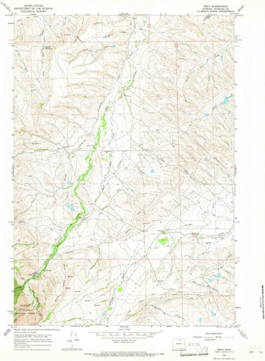
- USGS topographic map of Wolf, WY, at 1:24000 scale. Lighter material. Waterproof. Tear-resistant. Foldable. Very durable. Perfect for backpacking and the outdoors.
- Cities, towns, villages: Wolf
- Mountains: High elevation topographical features like high summits and peaks.
- Valleys: Parallel Draw,Lowe Draw
USGS topographic map of Wolf, Wyoming, dated 1964, updated 1967.
Includes geographic coordinates (latitude and longitude), lines of elevation, bodies of water, roads, and more. This topo quad is suitable for recreational, outdoor uses, office applications, or wall map framing.
Printed on-demand by YellowMaps on the print material of your choice.
Shipping rolled from Minneapolis, MN, United States.
Product Number: USGS-5616956
Map Size: 26.8 inches high x 21.3 inches wide
Map Scale: 1:24000
Map Type: POD USGS Topographic Map
Map Series: HTMC
Map Version: Historical
Cell ID: 72096
Scan ID: 341965
Imprint Year: 1967
Woodland Tint: Yes
Aerial Photo Year: 1963
Field Check Year: 1964
Datum: NAD27
Map Projection: Polyconic
Map published by United States Geological Survey
Map Language: English
Scanner Resolution: 600 dpi
Map Cell Name: Wolf
Grid size: 7.5 X 7.5 Minute
Date on map: 1964
Geographical region: Wyoming, United States
Northern map edge Latitude: 44.875°
Southern map edge Latitude: 44.75°
Western map edge Longitude: -107.25°
Eastern map edge Longitude: -107.125°
Surrounding map sheets (copy & paste the Product No. in the search bar):
North: USGS-5614976,USGS-5614978
East: USGS-5612750,USGS-5612748,USGS-5612752
South: USGS-5609772,USGS-5609776,USGS-5609774,USGS-5609778
West: USGS-5611146,USGS-5611150,USGS-5611148


 - Red & Green Serving Platters, Candy Trinket Tray, 7\" Fine Earthenware Plates, Dishwasher Safe Holiday Tableware for Seasonal Gatherings")

")

")


