- Printed on Regular Paper (32lb)
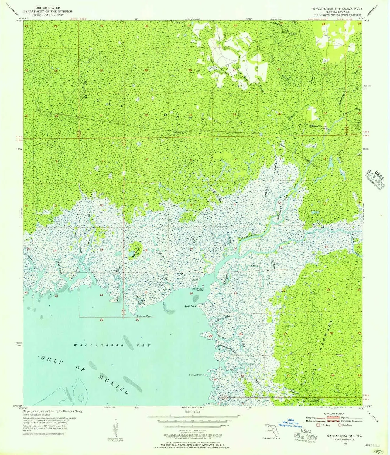
- USGS topographic map of Waccasassa Bay, FL, at 1:24000 scale. High-quality paper print. Perfect for wall maps.
- Cities, towns, villages: Please see map preview to find populated places, townships, as well as roads and street names if available.
- Rivers, creeks: Rocky Run,Sheephead Creek,Ramsey Creek,Trout Creek,Cow Creek,Crooked Creek,Divedapper Creek,Cabbage Slough,Watch Chain Slough,Tenmile Creek,Chicken Slough,Dry Creek,Compass Point Creek,Mud Creek,Wekiva River,Mud Creek,Williams Creek,Deep Creek,Salt Island Creek,Bird Creek,Waccasassa River,Otter Creek,Double Barrel Creek,Depew Creek,Soldiers Creek
- Lakes: Consult topo map preview for bodies of fresh water.
USGS topographic map of Waccasassa Bay, Florida, dated 1955, updated 1956.
Includes geographic coordinates (latitude and longitude), lines of elevation, bodies of water, roads, and more. This topo quad is suitable for recreational, outdoor uses, office applications, or wall map framing.
Printed on-demand by YellowMaps on the print material of your choice.
Shipping rolled from Minneapolis, MN, United States.
Product Number: USGS-5628640
Map Size: 26.8 inches high x 23 inches wide
Map Scale: 1:24000
Map Type: POD USGS Topographic Map
Map Series: HTMC
Map Version: Historical
Cell ID: 47075
Scan ID: 348968
Imprint Year: 1956
Woodland Tint: Yes
Aerial Photo Year: 1951
Survey Year: 1955
Datum: NAD27
Map Projection: Polyconic
Map published by United States Geological Survey
Map Language: English
Scanner Resolution: 600 dpi
Map Cell Name: Waccasassa Bay
Grid size: 7.5 X 7.5 Minute
Date on map: 1955
Geographical region: Florida, United States
Northern map edge Latitude: 29.25°
Southern map edge Latitude: 29.125°
Western map edge Longitude: -82.875°
Eastern map edge Longitude: -82.75°
Surrounding map sheets (copy & paste the Product No. in the search bar):
North: USGS-5626986,USGS-5626984,USGS-5626982
East: USGS-5625854,USGS-5625860,USGS-5625856,USGS-5625858
South: USGS-5689186,USGS-5689182,USGS-5689184,USGS-5689180
West: USGS-5628322,USGS-5628316,USGS-5628320,USGS-5628318


")

")


