- Printed on Tyvek® (synthetic)
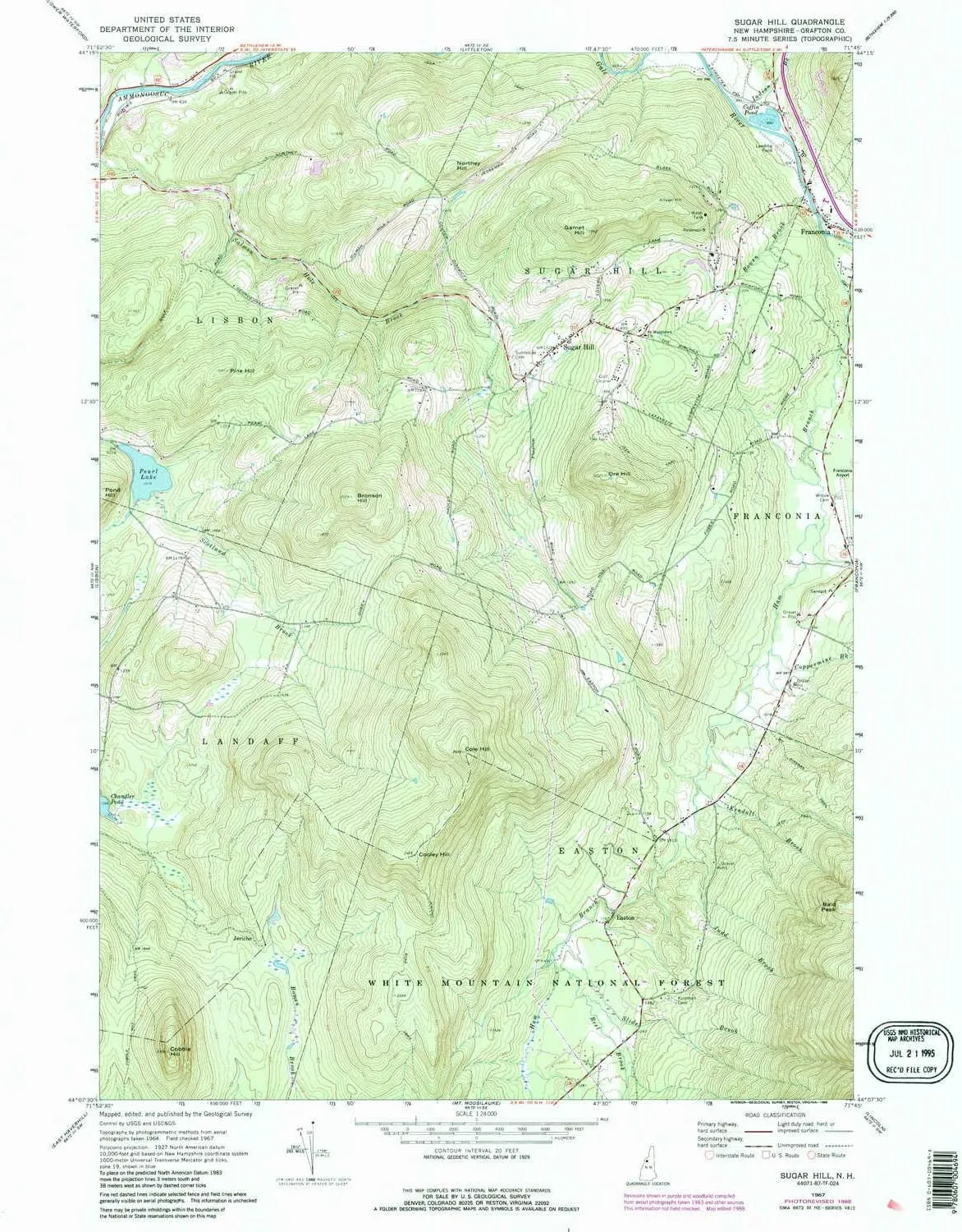
- USGS topographic map of Sugar Hill, NH, at 1:24000 scale. Lighter material. Waterproof. Tear-resistant. Foldable. Very durable. Perfect for backpacking and the outdoors.
- Cities, towns, villages: Easton,Sugar Hill,Jericho
- Mountains: Pine Hill,Pond Hill,Garnet Hill,Bronson Hill,Northey Hill,Sugar Hill,Cooley Hill,Ore Hill,Cole Hill,Cobble Hill,Bald Peak
- Valleys: Low elevation topographic features such as flatlands, river valleys, and canyons.
USGS topographic map of Sugar Hill, New Hampshire, dated 1967, updated 1988.
Includes geographic coordinates (latitude and longitude), lines of elevation, bodies of water, roads, and more. This topo quad is suitable for recreational, outdoor uses, office applications, or wall map framing.
Printed on-demand by YellowMaps on the print material of your choice.
Shipping rolled from Minneapolis, MN, United States.
Product Number: USGS-5582908
Map Size: 26.8 inches high x 21.6 inches wide
Map Scale: 1:24000
Map Type: POD USGS Topographic Map
Map Series: HTMC
Map Version: Historical
Cell ID: 43615
Scan ID: 329812
Imprint Year: 1988
Woodland Tint: Yes
Photo Revision Year: 1988
Aerial Photo Year: 1983
Edit Year: 1988
Field Check Year: 1967
Datum: NAD27
Map Projection: Polyconic
Map published by United States Geological Survey
Map Language: English
Scanner Resolution: 600 dpi
Map Cell Name: Sugar Hill
Grid size: 7.5 X 7.5 Minute
Date on map: 1967
Geographical region: New Hampshire, United States
Northern map edge Latitude: 44.25°
Southern map edge Latitude: 44.125°
Western map edge Longitude: -71.875°
Eastern map edge Longitude: -71.75°
Surrounding map sheets (copy & paste the Product No. in the search bar):
North: USGS-5582552,USGS-5582554,USGS-5582556
East: USGS-5582432,USGS-5582428,USGS-5582430,USGS-5582434
South: USGS-5582668,USGS-5582648,USGS-5582662,USGS-5582670
West: USGS-5582542,USGS-5582550,USGS-5677440,USGS-5582548,USGS-5582546


 High-Performance Camping Chair, Forest Green")


