- Printed on Tyvek® (synthetic)
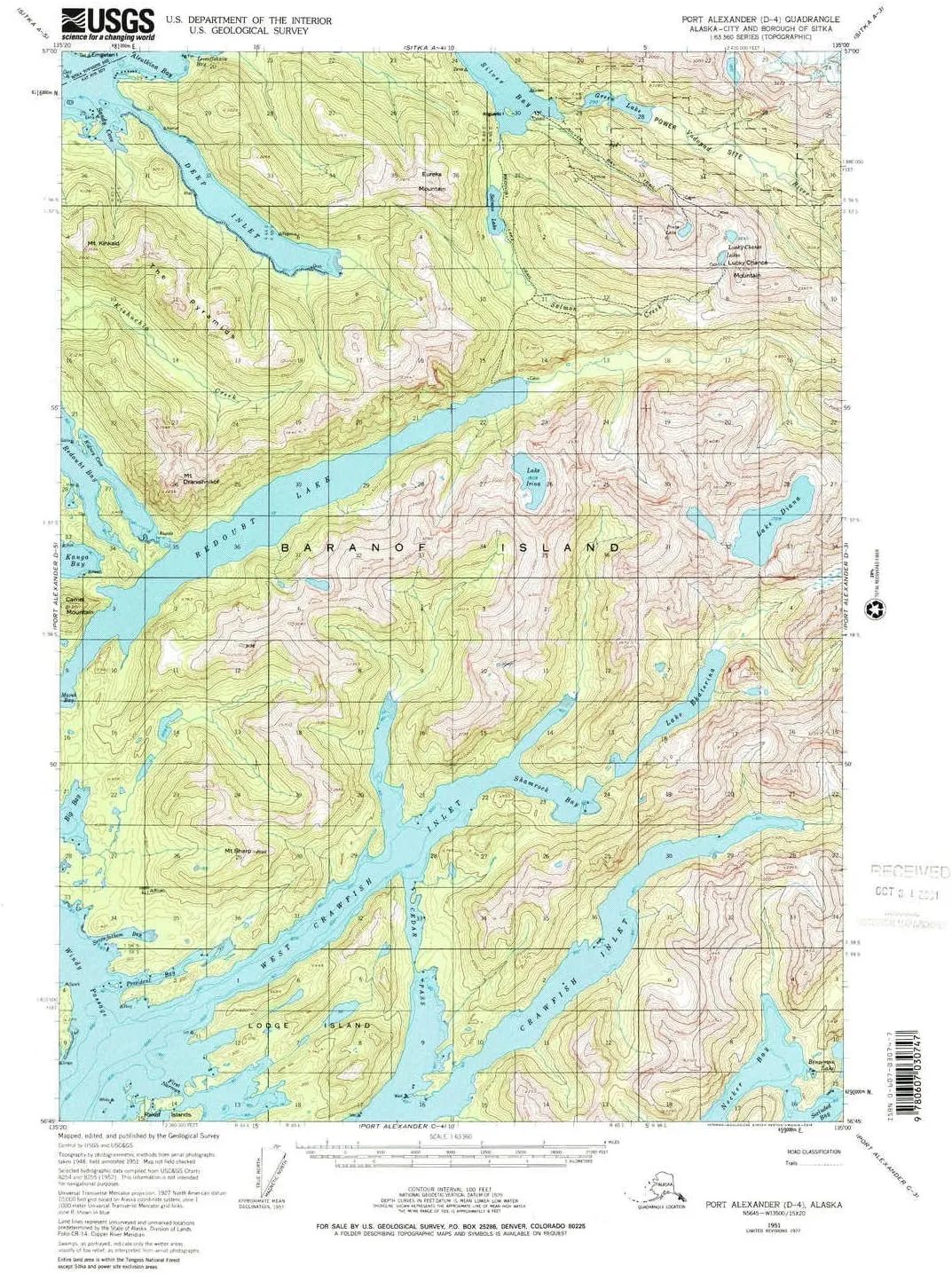
- USGS topographic map of Port Alexander D 4, AK, at 1:63360 scale. Lighter material. Waterproof. Tear-resistant. Foldable. Very durable. Perfect for backpacking and the outdoors.
- Cities, towns, villages: Silver Bay (historical),The Redoubt (historical)
- Mountains: Mount Kinkaid,Lucky Chance Mountain,Mount Longenbaugh,Camel Mountain,The Pyramids,Mount Sharp,Mount Dranishnikof,Eureka Mountain
- Valleys: Low elevation topographic features such as flatlands, river valleys, and canyons.

![[4G 32G] Android 13 5GWIFI Car Radio Stereo for Jeep Compass Patriot 2010-2016 with Wireless CarPlay Android Auto, 10.1 inch Touchscreen Car Stereo with Bluetooth,WiFi,DSP,GPS,Backup Camera](https://www.icecramp.shop/image/4g-32g-android-13-5gwifi-car-radio-stereo-for-jeep-compass-patriot-2010-2016-with-wireless-carplay-android-auto-101-inch-touchscreen-car-stereo-with-bluetoothwifidspgpsbackup-camera_ARxznc_300x.webp "[4G 32G] Android 13 5GWIFI Car Radio Stereo for Jeep Compass Patriot 2010-2016 with Wireless CarPlay Android Auto, 10.1 inch Touchscreen Car Stereo with Bluetooth,WiFi,DSP,GPS,Backup Camera")


")
")

![Coleman Cooler Quad Chair - Blue [2000035685]](https://www.icecramp.shop/image/coleman-cooler-quad-chair-blue-2000035685_KdTCVB_300x.webp "Coleman Cooler Quad Chair - Blue [2000035685]")

