- Printed on Tyvek® (synthetic)
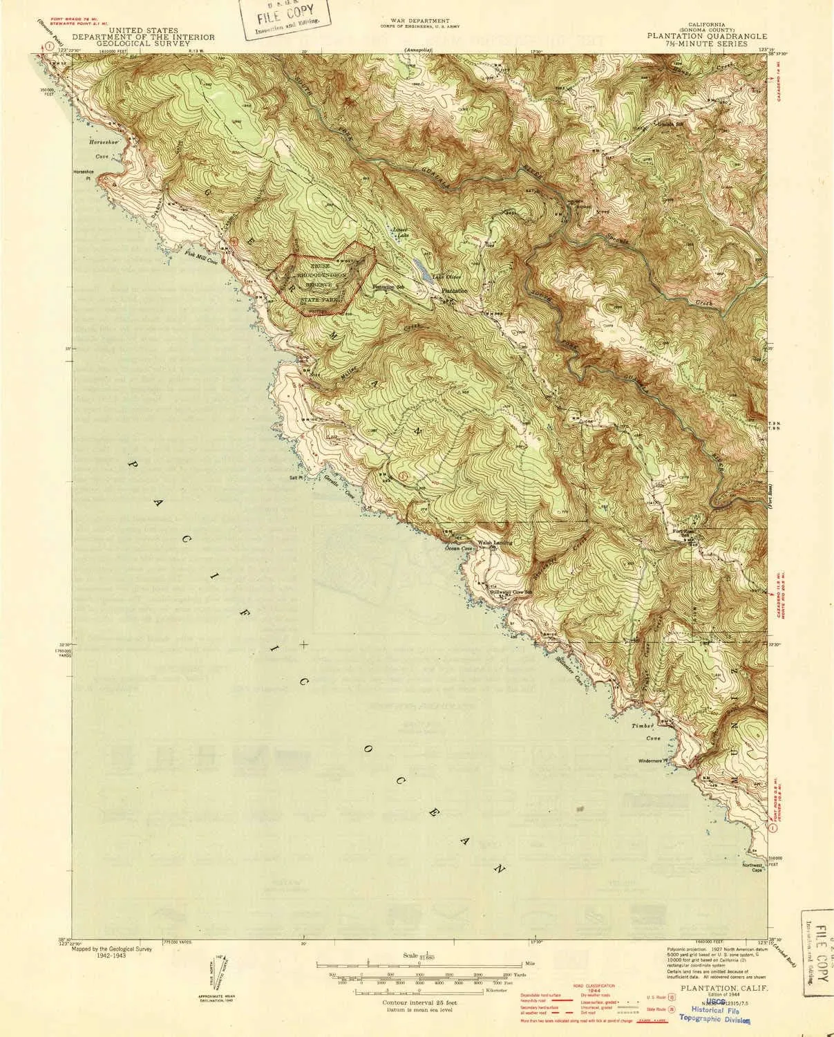
- USGS topographic map of Plantation, CA, at 1:31680 scale. Lighter material. Waterproof. Tear-resistant. Foldable. Very durable. Perfect for backpacking and the outdoors.
- Cities, towns, villages: Walsh Landing
- Mountains: High elevation topographical features like high summits and peaks.
- Valleys: Cannon Gulch,Deadman Gulch,Phillips Gulch,Kolmer Gulch,Chinese Gulch
USGS topographic map of Plantation, California, dated 1944.
Includes geographic coordinates (latitude and longitude), lines of elevation, bodies of water, roads, and more. This topo quad is suitable for recreational, outdoor uses, office applications, or wall map framing.
Printed on-demand by YellowMaps on the print material of your choice.
Shipping rolled from Minneapolis, MN, United States.
Product Number: USGS-5682969
Map Size: 20.2 inches high x 16.2 inches wide
Map Scale: 1:31680
Map Type: POD USGS Topographic Map
Map Series: HTMC
Map Version: Historical
Cell ID: 35571
Scan ID: 296417
Woodland Tint: Yes
Datum: NAD27
Map Projection: Polyconic
Map published by United States Geological Survey
Map published by United States Army Corps of Engineers
Map published by United States Department of War
Keywords: Overedge with No Adjacent Map
Map Language: English
Scanner Resolution: 600 dpi
Map Cell Name: Plantation
Grid size: 7.5 X 7.5 Minute
Date on map: 1944
Geographical region: California, United States
Northern map edge Latitude: 38.625°
Southern map edge Latitude: 38.5°
Western map edge Longitude: -123.375°
Eastern map edge Longitude: -123.25°
Surrounding map sheets (copy & paste the Product No. in the search bar):
North: USGS-5507487,USGS-5507495,USGS-5507489,USGS-5507491,USGS-5507493
East: USGS-5514059,USGS-5514067,USGS-5514065,USGS-5514063,USGS-5514061
South:
West:


