- Printed on Regular Paper (32lb)
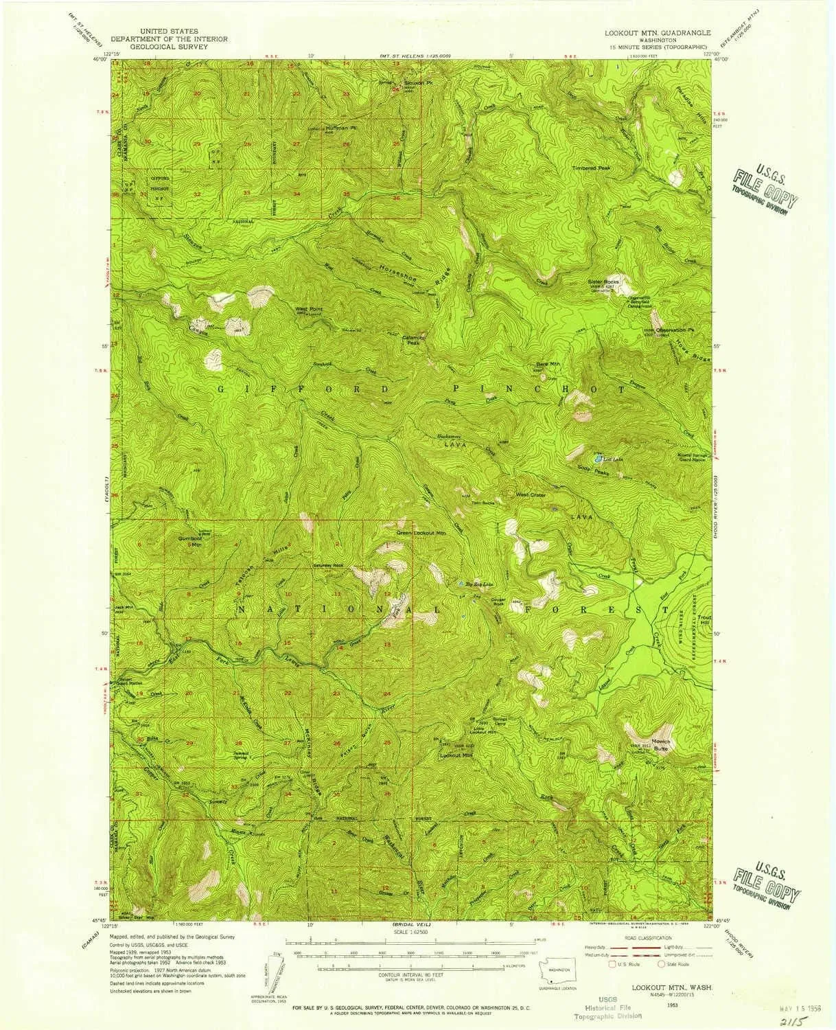
- USGS topographic map of Lookout Mtn, WA, at 1:62500 scale. High-quality paper print. Perfect for wall maps.
- Cities, towns, villages: Please see map preview to find populated places, townships, as well as roads and street names if available.
- Rivers, creeks: Jakes Creek,Layout Creek,Bolin Creek,Little Creek,Green Fork,West Creek,Bear Creek,Calamity Creek,Chinook Creek,Wildcat Creek,North Fork Snag Creek,Slide Creek,Grouse Creek,Meander Creek,East Fork Trout Creek,Compass Creek,Sorehead Creek,Pelvy Creek,Snag Creek,Horseshoe Creek,Miners Creek,McKinley Creek,Summit Creek,Big Rock Creek,Pass Creek,Puny Creek,Star Creek,Crater Creek,Timber Creek,Lookout Creek,Hackamore Creek
- Lakes: Zig Zag Lake,Soda Peaks Lake,Rock Creek Lake
USGS topographic map of Lookout Mtn, Washington, dated 1953, updated 1956.
Includes geographic coordinates (latitude and longitude), lines of elevation, bodies of water, roads, and more. This topo quad is suitable for recreational, outdoor uses, office applications, or wall map framing.
Printed on-demand by YellowMaps on the print material of your choice.
Shipping rolled from Minneapolis, MN, United States.
Product Number: USGS-5410136
Map Size: 20.9 inches high x 17 inches wide
Map Scale: 1:62500
Map Type: POD USGS Topographic Map
Map Series: HTMC
Map Version: Historical
Cell ID: 56892
Scan ID: 242056
Imprint Year: 1956
Woodland Tint: Yes
Aerial Photo Year: 1952
Field Check Year: 1953
Datum: NAD27
Map Projection: Polyconic
Map published by United States Geological Survey
Map Language: English
Scanner Resolution: 600 dpi
Map Cell Name: Lookout Mountain
Grid size: 15 X 15 Minute
Date on map: 1953
Geographical region: Washington, United States
Northern map edge Latitude: 46°
Southern map edge Latitude: 45.75°
Western map edge Longitude: -122.25°
Eastern map edge Longitude: -122°
Surrounding map sheets (copy & paste the Product No. in the search bar):
North: USGS-5410326,USGS-5410324,USGS-5406728,USGS-5410322,USGS-5406730
East: USGS-5410908,USGS-5408314,USGS-5410912,USGS-5410910,USGS-5408316
South: USGS-5402852,USGS-5402854,USGS-5409582,USGS-5409584,USGS-5402850
West: USGS-5403836,USGS-5410924,USGS-5410922,USGS-5410920,USGS-5403838


")


