- Printed on Regular Paper (32lb)
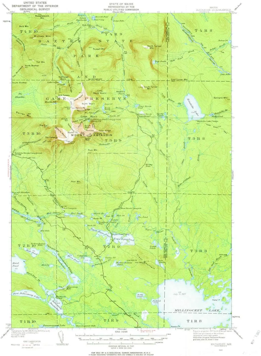
- USGS topographic map of Katahdin, ME, at 1:62500 scale. High-quality paper print. Perfect for wall maps.
- Cities, towns, villages: New City
- Rivers, creeks: Annis Brook,South Turner Brook,Spring Brook,Sandy Stream,Mullen Brook,Rum Brook,Beaver Brook,Roaring Brook,Hurd Pond Stream,Pockwockamus Stream,South Branch Wassataquoik Stream,Togue Stream,Avalanche Brook,Turner Brook,Big Mud Brook,Balm of Gilead Brook,Abol Stream,Foss and Knowlton Brook,Otter Brook,Robar Brook,Katahdin Stream,Twin Pond Brook
- Lakes: Sunday Pond,Depot Pond,Debsconeag Deadwater,Whidden Ponds,Rum Pond,Pamola Pond,Dry Pond,Hale Pond,Rober Pond,Compass Pond,Klondike Pond,Abol Pond,First Debsconeag Lake,Upper Togue Pond,Davis Pond,Turner Deadwater,Martin Ponds,Twin Ponds,Lower Togue Pond,Hurd Pond,Round Pond,Katahdin Lake,Rocky Pond,Pockwockamus Pond,Oak Hill Pond,Twin Ponds
USGS topographic map of Katahdin, Maine, dated 1949, updated 1963.
Includes geographic coordinates (latitude and longitude), lines of elevation, bodies of water, roads, and more. This topo quad is suitable for recreational, outdoor uses, office applications, or wall map framing.
Printed on-demand by YellowMaps on the print material of your choice.
Shipping rolled from Minneapolis, MN, United States.
Product Number: USGS-5684443
Map Size: 20.8 inches high x 17 inches wide
Map Scale: 1:62500
Map Type: POD USGS Topographic Map
Map Series: HTMC
Map Version: Historical
Cell ID: 56014
Scan ID: 460508
Imprint Year: 1963
Woodland Tint: Yes
Edit Year: 1949
Survey Year: 1927
Datum: NAD27
Map Projection: Polyconic
Map published by United States Geological Survey
Map Language: English
Scanner Resolution: 600 dpi
Map Cell Name: Katahdin
Grid size: 15 X 15 Minute
Date on map: 1949
Geographical region: Maine, United States
Northern map edge Latitude: 46°
Southern map edge Latitude: 45.75°
Western map edge Longitude: -69°
Eastern map edge Longitude: -68.75°
Surrounding map sheets (copy & paste the Product No. in the search bar):
North: USGS-5535663,USGS-5537405,USGS-5537179,USGS-5685333,USGS-5537403
East: USGS-5535771,USGS-5535435,USGS-5537135,USGS-5685255,USGS-5685257
South: USGS-5534899,USGS-5534901,USGS-5684755,USGS-5536817,USGS-5536815
West: USGS-5535055,USGS-5684379,USGS-5536587,USGS-5535053,USGS-5684383


")


