- Printed on Regular Paper (32lb)
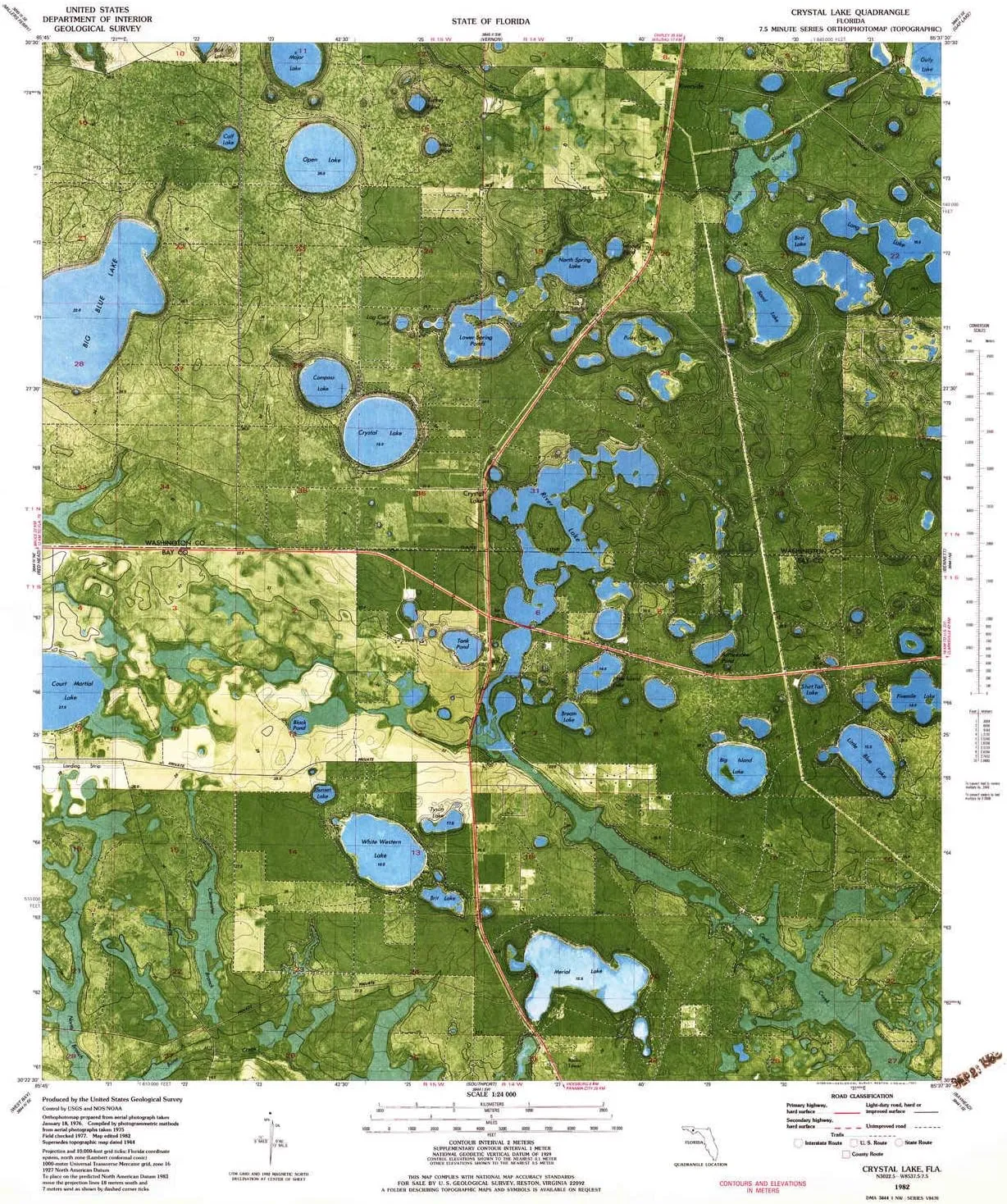
- USGS topographic map of Crystal Lake, FL, at 1:24000 scale. High-quality paper print. Perfect for wall maps.
- Cities, towns, villages: Crystal Lake
- Rivers, creeks: Clearwater Branch
- Lakes: Bream Lake,Tyson Lake,Wash Pond,River Lake,Rattlesnake Lake,White Western Lake,Piney Lake,Island Pond,Bird Lake,Big Island Lake,Little Blue Lake,Black Pond,Compass Lake,Gator Pond,Lower Spring Ponds,Crystal Lake,Woody Pond,Major Lake,Big Blue Lake,Long Lake,Turkey Pond,Shirt Tail Lake,Merial Lake,North Spring Lake,Lake Five-O,Tank Pond,Sunset Lake
USGS topographic map of Crystal Lake, Florida, dated 1982, updated 1983.
Includes geographic coordinates (latitude and longitude), lines of elevation, bodies of water, roads, and more. This topo quad is suitable for recreational, outdoor uses, office applications, or wall map framing.
Printed on-demand by YellowMaps on the print material of your choice.
Shipping rolled from Minneapolis, MN, United States.
Product Number: USGS-5623328
Map Size: 27 inches high x 23 inches wide
Map Scale: 1:24000
Map Type: POD USGS Topographic Map
Map Series: HTMC
Map Version: Historical
Cell ID: 10934
Scan ID: 345706
Imprint Year: 1983
Woodland Tint: Yes
Aerial Photo Year: 1975
Edit Year: 1982
Field Check Year: 1977
Datum: NAD27
Map Projection: Lambert Conformal Conic
Orthophoto: Map
Map published by United States Geological Survey
Map Language: English
Scanner Resolution: 600 dpi
Map Cell Name: Crystal Lake
Grid size: 7.5 X 7.5 Minute
Date on map: 1982
Geographical region: Florida, United States
Northern map edge Latitude: 30.5°
Southern map edge Latitude: 30.375°
Western map edge Longitude: -85.75°
Eastern map edge Longitude: -85.625°
Surrounding map sheets (copy & paste the Product No. in the search bar):
North: USGS-5628612,USGS-5628610,USGS-5628608
East: USGS-5620718,USGS-5620720,USGS-5622308,USGS-5622306,USGS-5622310
South: USGS-5628098,USGS-5620984,USGS-5620980,USGS-5628096,USGS-5620982
West: USGS-5627522,USGS-5620954,USGS-5620956,USGS-5627526,USGS-5627524
")


")
")
