- Printed on Regular Paper (32lb)
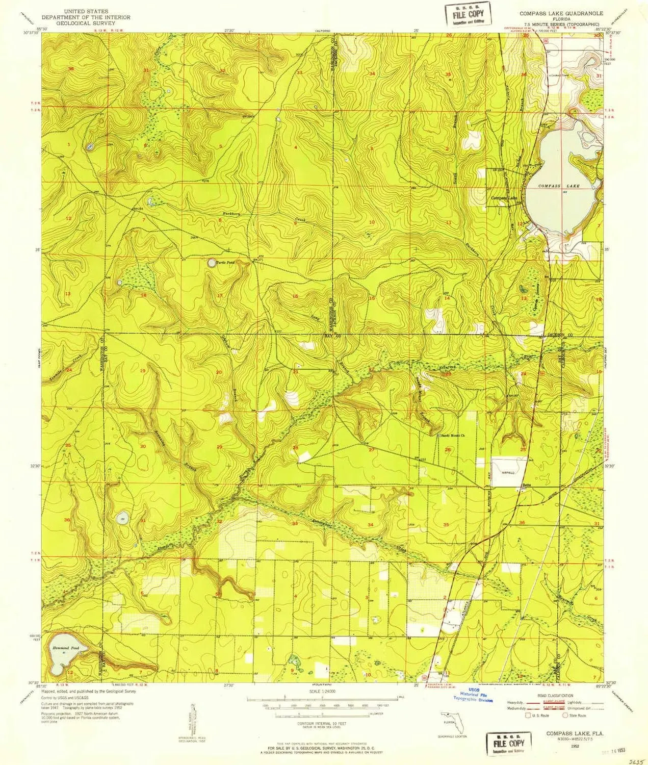
- USGS topographic map of Compass Lake, FL, at 1:24000 scale. High-quality paper print. Perfect for wall maps.
- Cities, towns, villages: Betts,Compass Lake
- Rivers, creeks: Tenmile Creek,Sewell Branch,Goshum Branch,Branning Branch,Sandy Mountain Branch,Sweetwater Creek,Long Branch,Bailey Branch,Buckhorn Creek
- Lakes: Turnip Pond,Compass Lake,Hammond Lake
USGS topographic map of Compass Lake, Florida, dated 1952, updated 1953.
Includes geographic coordinates (latitude and longitude), lines of elevation, bodies of water, roads, and more. This topo quad is suitable for recreational, outdoor uses, office applications, or wall map framing.
Printed on-demand by YellowMaps on the print material of your choice.
Shipping rolled from Minneapolis, MN, United States.
Product Number: USGS-5623126
Map Size: 26.8 inches high x 22.9 inches wide
Map Scale: 1:24000
Map Type: POD USGS Topographic Map
Map Series: HTMC
Map Version: Historical
Cell ID: 9782
Scan ID: 345591
Imprint Year: 1953
Woodland Tint: Yes
Aerial Photo Year: 1947
Survey Year: 1952
Datum: NAD27
Map Projection: Polyconic
Map published by United States Geological Survey
Map Language: English
Scanner Resolution: 600 dpi
Map Cell Name: Compass Lake
Grid size: 7.5 X 7.5 Minute
Date on map: 1952
Geographical region: Florida, United States
Northern map edge Latitude: 30.625°
Southern map edge Latitude: 30.5°
Western map edge Longitude: -85.5°
Eastern map edge Longitude: -85.375°
Surrounding map sheets (copy & paste the Product No. in the search bar):
North: USGS-5621836,USGS-5621840,USGS-5621838,USGS-5621842
East: USGS-5621834
South: USGS-5624430,USGS-5620812,USGS-5620814,USGS-5624432
West: USGS-5624516,USGS-5624518,USGS-5624520,USGS-5624522


")
")


