- Printed on Tyvek® (synthetic)
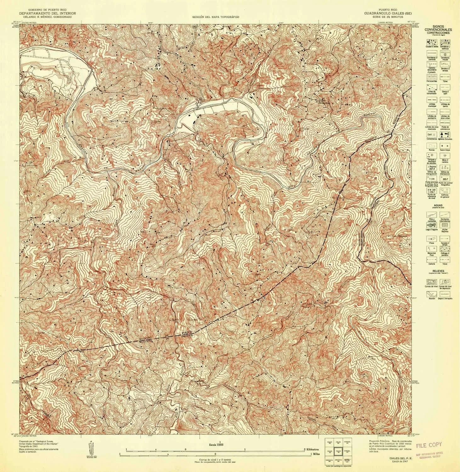
- USGS topographic map of Ciales SE, PR, at 1:10000 scale. Lighter material. Waterproof. Tear-resistant. Foldable. Very durable. Perfect for backpacking and the outdoors.
- Cities, towns, villages: Please see map preview to find populated places, townships, as well as roads and street names if available.
- Mountains: Cerro Malo,Cerro Magueyes,Cerro Avispa,Cerro Quirós
- Valleys: Quebrada Las Ánimas,Quebrada La Mina,Quebrada Minas,Quebrada Barros,Quebrada Grande,Quebrada Ciénaga,Quebrada Los Cabros,Quebrada del Muerto,Quebrada Perchas
USGS topographic map of Ciales SE, Puerto Rico, dated 1947.
Includes geographic coordinates (latitude and longitude), lines of elevation, bodies of water, roads, and more. This topo quad is suitable for recreational, outdoor uses, office applications, or wall map framing.
Printed on-demand by YellowMaps on the print material of your choice.
Shipping rolled from Minneapolis, MN, United States.
Product Number: USGS-5654110
Map Size: 31.3 inches high x 30.5 inches wide
Map Scale: 1:10000
Map Type: POD USGS Topographic Map
Map Series: HTMC
Map Version: Historical
Cell ID: 137920
Scan ID: 361974
Survey Year: 1943
Datum: Unstated
Map Projection: Polyconic
Preliminary map: Yes
Map published by United States Geological Survey
Map Language: Spanish
Scanner Resolution: 600 dpi
Map Cell Name: Ciales SE
Grid size: 3.75 X 3.75 Minute
Date on map: 1947
Geographical region: Puerto Rico, United States
Northern map edge Latitude: 18.3125°
Southern map edge Latitude: 18.25°
Western map edge Longitude: -66.4375°
Eastern map edge Longitude: -66.375°
Surrounding map sheets (copy & paste the Product No. in the search bar):
North: USGS-5654106
East: USGS-5654716,USGS-5655254,USGS-5655252,USGS-5654136,USGS-5655250
South:
West: USGS-5654112


