- Printed on Regular Paper (32lb)
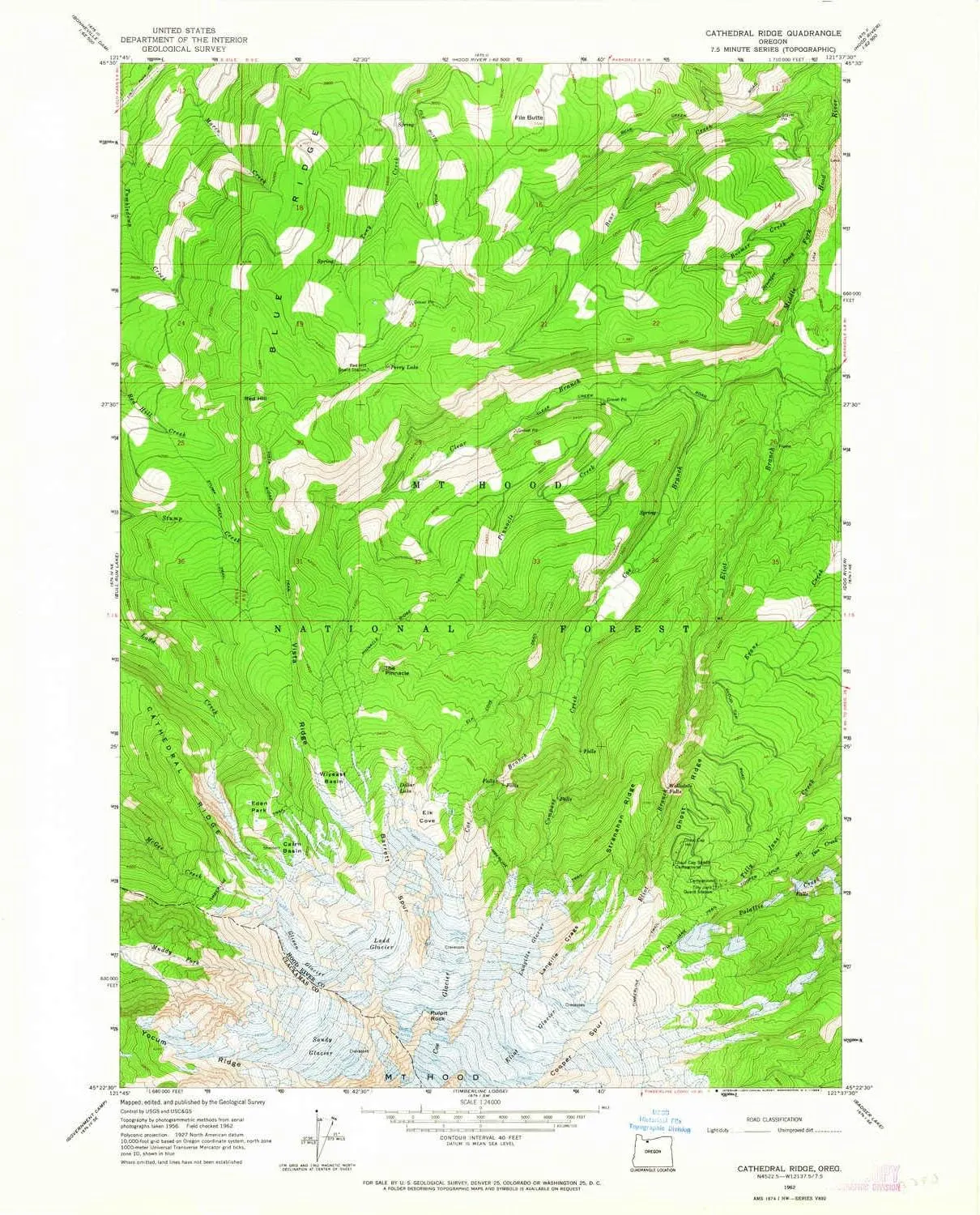
- USGS topographic map of Cathedral Ridge, OR, at 1:24000 scale. High-quality paper print. Perfect for wall maps.
- Cities, towns, villages: Please see map preview to find populated places, townships, as well as roads and street names if available.
- Rivers, creeks: Compass Creek,Squeegee Creek,Coe Branch,Bear Creek,Pinnacle Creek,Boomer Creek,Eliot Branch,Clear Branch
- Lakes: Perry Lake,Dollar Lake,Recession Lakes
USGS topographic map of Cathedral Ridge, Oregon, dated 1962, updated 1964.
Includes geographic coordinates (latitude and longitude), lines of elevation, bodies of water, roads, and more. This topo quad is suitable for recreational, outdoor uses, office applications, or wall map framing.
Printed on-demand by YellowMaps on the print material of your choice.
Shipping rolled from Minneapolis, MN, United States.
Product Number: USGS-5417252
Map Size: 27 inches high x 22.1 inches wide
Map Scale: 1:24000
Map Type: POD USGS Topographic Map
Map Series: HTMC
Map Version: Historical
Cell ID: 30637
Scan ID: 279294
Imprint Year: 1964
Woodland Tint: Yes
Aerial Photo Year: 1956
Field Check Year: 1962
Datum: NAD27
Map Projection: Polyconic
Map published by United States Geological Survey
Map Language: English
Scanner Resolution: 600 dpi
Map Cell Name: Mount Hood North
Grid size: 7.5 X 7.5 Minute
Date on map: 1962
Geographical region: Oregon, United States
Northern map edge Latitude: 45.5°
Southern map edge Latitude: 45.375°
Western map edge Longitude: -121.75°
Eastern map edge Longitude: -121.625°
Surrounding map sheets (copy & paste the Product No. in the search bar):
North: USGS-5417848,USGS-5544856,USGS-5544852,USGS-5417850,USGS-5544854
East: USGS-5417964,USGS-5417962,USGS-5417970,USGS-5417968,USGS-5417966
South: USGS-5420328,USGS-5420324,USGS-5422306,USGS-5420326,USGS-5420330
West: USGS-5417054,USGS-5417056,USGS-5417052,USGS-5417050


, Floral Pattern, Dishwasher Safe, Microwave Safe, Tableware, Gift,")


