- Printed on Tyvek® (synthetic)
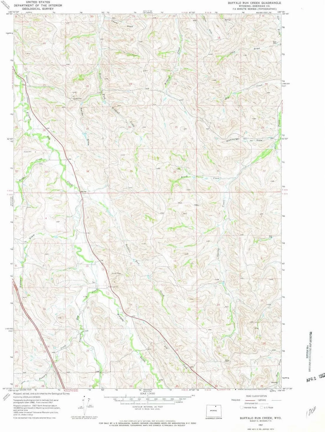
- USGS topographic map of Buffalo Run Creek, WY, at 1:24000 scale. Lighter material. Waterproof. Tear-resistant. Foldable. Very durable. Perfect for backpacking and the outdoors.
- Cities, towns, villages: Please see map preview to find populated places, townships, as well as roads and street names if available.
- Mountains: High elevation topographical features like high summits and peaks.
- Valleys: Sandy Draw,Duncan Draw,Lewis Draw,Hamburger Draw,John Draw,Murphy Gulch
USGS topographic map of Buffalo Run Creek, Wyoming, dated 1967, updated 1972.
Includes geographic coordinates (latitude and longitude), lines of elevation, bodies of water, roads, and more. This topo quad is suitable for recreational, outdoor uses, office applications, or wall map framing.
Printed on-demand by YellowMaps on the print material of your choice.
Shipping rolled from Minneapolis, MN, United States.
Product Number: USGS-5610334
Map Size: 26.8 inches high x 21.6 inches wide
Map Scale: 1:24000
Map Type: POD USGS Topographic Map
Map Series: HTMC
Map Version: Historical
Cell ID: 6067
Scan ID: 338719
Imprint Year: 1972
Woodland Tint: Yes
Aerial Photo Year: 1966
Field Check Year: 1967
Datum: NAD27
Map Projection: Polyconic
Map published by United States Geological Survey
Map Language: English
Scanner Resolution: 600 dpi
Map Cell Name: Buffalo Run Creek
Grid size: 7.5 X 7.5 Minute
Date on map: 1967
Geographical region: Wyoming, United States
Northern map edge Latitude: 44.75°
Southern map edge Latitude: 44.625°
Western map edge Longitude: -106.875°
Eastern map edge Longitude: -106.75°
Surrounding map sheets (copy & paste the Product No. in the search bar):
North: USGS-5616994,USGS-5616992
East: USGS-5616646
South: USGS-5609650,USGS-5609652,USGS-5609654
West: USGS-5609846,USGS-5609844,USGS-5609842


![Thetford Raw Water System Eco Kit w/Rocker Switch, Wire Harness Fitting [T-PF.P130]](https://www.icecramp.shop/image/thetford-raw-water-system-eco-kit-wrocker-switch-wire-harness-fitting-t-pfp130_d4N08f_300x.webp "Thetford Raw Water System Eco Kit w/Rocker Switch, Wire Harness Fitting [T-PF.P130]")
